Camping on a riverbank is something many people like to do, and I am lucky enough to be doing that. This is Arizona so it is more of a 'bank' than a river. But I always like arroyos. This one had a special gift for me.
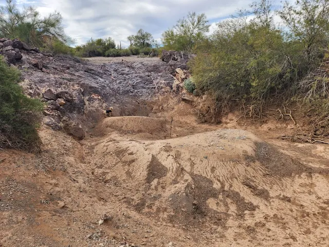
Miles of nice, navigable gravel. In one spot and one spot only, a 10 foot high waterfall sits across the arroyo. The rock waterfall is steeper than the photo shows: you couldn't walk up it. But the Little Cute One surprised me by scampering up the rock waterfall.
In the middle of the photo is a hiking pole, to indicate scale. The gushing water has left two holes that are 3 or 4 feet deep. How deep would the water have to be above the waterfall in order to dig out such deep holes? I wonder how fast the water was moving?
Notice that the holes are dirt, but there are no plants growing in it. That would imply that the water event was recent. The monsoon season this past summer was quite spirited. But are you willing to believe the holes were dug out by one big water event, or many (cumulative) smaller ones, occurring every few years in the desert?
One of these summers (!) I will come down to Arizona just to see water flow. It would be worth it. But how can you be sure to be at the right place and right time to see a real gully-washer?
I am too lazy to learn enough geology to explain any of this. Actually, if geology books weren't so choked with jargon, I might learn some of it. But it is always fun to try to imagine natural processes, rather than merely admire "perdy" scenery. And when you get a chance to do so in your campsite's backyard, that is truly special.


Comments